Keeping Your Hands Warm Winter Hiking

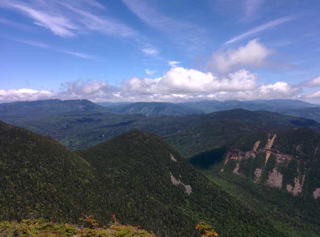
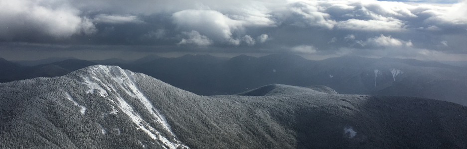
Keeping your hands warm when winter hiking is critical to enjoying your time in the outdoors. This post contains information about how I go about crafting a layering scheme to keep my hands warm when hiking above and below treeline on even the coldest days in the winter. It also has a series of tips and tricks that I use to help keep my hands warm and happy, and a few tips to help debug why your hands might still be cold even once you’ve purchased a nice pair of mittens.

Layering for your Hands

Just like how you have to come up with a good layering scheme for your body to manage sweat and stop yourself from overheating when winter hiking, the same is absolutely true for your hands. With so many varied situations you might find yourself in, there is no one-stop-shop glove for any price that will suit your needs in all conditions you may experience. This will probably seem excessive to the light-and-fast crowd, but I typically carry five different layering pieces for my hands on every hike, with backups for the ones that get wet most often. This many layers let me constantly adjust my hands for different amounts of necessary warmth and dexterity.

Vapor Barrier Layer (Optional)

The first layer I typically have in my pack is a pair of latex (or non-latex) gloves that I can use to create a vapor barrier between my hand and the outside world when conditions really get cold. While it doesn’t allow sweat to evaporate off your hands, the vapor barrier works by creating a micro-climate around your hand that actually stops your hand from sweating once it hits a certain moisture level. The vapor barrier helps block wind and water from reaching my hand which overall can improve warm.

Sweat Management Layer

This layer is often referred to as a “liner glove” and is responsible for taking the sweat your body is producing on your hand and transporting it away from your skin. This action helps stop your hand getting chilled by the wind. These layers are typically made of either Wool or Synthetic and are very light and stretchy. They offer a small amount of protection from the wind but almost no protection from outside water sources (rain, snow, etc). I usually hike with at least three of this layer since by design it will become wet over time as it attempts to transport your sweat from skin to air. I typically start a hike with one of these on and it rarely leaves my hand during the day. Halfway through the hike I switch to a dry pair, and one pair stays dry in my pack as a backup.

Buying Advice

Fit: Liners should not hang loosely on your hands, or be too stretched out when putting them on. They should be comfortable similar to wearing a base layer on your torso.
Durability: These liners will take a lot of abuse and it is often worth upgrading to a brand known for their durability.
Features: If you use your phone for pictures make sure your liners are also touch screen compatible!

I’ve been carrying three pairs of Smartwool Liner Gloves for the last few years and like how they hold up better than other similar liners I’ve used.

Mid-weight Warmth Layer

Most of the time on below treeline hikes I’m totally fine just wearing a liner glove throughout the moving portion of the day and a shell glove during breaks. However on really cold days it’s important to have an extra warmth layer that can be worn to keep your hands toasty while still allowing some sweat to escape when you’re working hard. These mid-layers are typically made of fleece and come in a variety of thicknesses depending on your preference. Most will be heavy enough to block a fair amount of wind but still don’t provide more than incidental moisture protection.

Buying Advice

Fit: Find a pair that fits when worn with your thinner liner gloves to stack the benefits (and warmth) of each layer.
Features: Leather or Rubber on the palms (either full or patterned) can help with grip and dexterity. Some gloves will have elastic around the wrist to help lock out drafts and snow.

Black Diamond makes a nice Fleece Mid-Weight Liner Glove that I find offers a good balance between dexterity and warmth. I carry one pair on each hike and typically keep it in a dry-bag for when it’s really needed.

Shell Layers (Gloves and Mittens)

The last layers you absolutely must have when winter hiking are good waterproof shell layers. Typically most hikers will take both a heavyweight glove for dexterity and a heavyweight mitten for warmth. In either case both should be well-made of either Synthetic (Goretex or equivalent) or Leather and be absolutely wind and waterproof. These gloves are your first line of defense against the elements on a windy day above treeline or when your encounter unexpected wet wintery mix.

Buying Advice

Fit: It is critical when sizing gloves and mittens that they’re both comfortable and not too tight when you’re wearing them with your liner gloves. You should never have to expose your bare hand in order to switch from one layer to your shells. Currently I size my shell gloves so that they fit with my light liners and size my mittens so that they fit with my mid-weight fleece gloves.
Dexterity: When buying gloves or mittens try wearing them with the liners you expect to wear and see if you can perform simple tasks. If you can’t eat / drink / zip with them on you will be frequently taking them off to perform these tasks. I usually check if I can unzip my coat or bag and unscrew the top off a water bottle.
Features: Shells are certainly the most feature rich of your hand layering scheme. Here are the ones you are most likely to encounter:

    • Leash – To me a leash is critical. The leash is a thin coord that connects the glove or mitten to your wrist. It allows you to take it off without worrying that it will blow away. Very comforting above treeline.
    • Elastic Gauntlet – Allows you to cinch the glove tight around your wrist to stop both cold air and snow from getting inside.
    • Hand Warmer Pocket – A small pocket on the top of the glove where a hand warmer can be placed.
    • Nose Wipe – Some gloves will have a velvet patch on the nose / pointer finger to make wiping your nose a little more pleasant. After 6 hours of rubbing your nose this is actually incredibly welcome.
    • Clips – Allows the gloves to be clipped together to avoid losing either side.
    • Pull Loop – Allows the glove to be pulled off easier.

With large hands and poor circulation, I went through many gloves before I found ones that worked for me. I landed on a Hestra C-Zone Ski and Cold Weather Gloves for a waterproof glove and a Burton Gore-tex Mitt for my mittens. Both have served my very well on many trips each winter season.

Hand Warmth Tips and Tricks

Here is a list of tips and tricks that I use along with my layering scheme to help expedite the warming process when my hands really start feeling the chill on a hike.

Use your Body, Not your Hands, to Heat your Gloves

This trick is actually quite popular when ice climbing but has completely changed my winter hiking experience as well. Instead of keeping your gloves in the brain or body of your pack keep them inside your torso layers so that they are pre-warmed by your body. When you first put on cold gloves your hands need to warm the glove before they can capture heat for themselves. This can lead to making your hands colder directly after your put on your gloves. By warming them against your body first they’re ready to go when you put them on. Above treeline I will typically keep whichever glove or mitten I’m not currently wearing warm inside my shell jacket.

Tight Gloves = Cold Hands

If your gloves are too tight or if they’ve been cinched down too tight it can prevent nice warm blood from flowing to your hands. Buying a size too small, not trying them on with your liners, or strapping them too tight can all lead to restricted blood flow to your hands. If you put on a pair of gloves or mittens and find that your hands are still getting colder, try loosening them or taking them off and see if you feel the return of normal circulation to your hands. If you do, bring them back to the store and get a size up.

Hand Warmers Can and Do Fail

If you typically find yourself with cold hands when hiking its a good idea to hike with hand warmers. These warmers typically rely on a chemical reaction with the air to generate heat for 6 – 12 hours depending on the brand. They are mass-produced however and defective ones do slip through to the public. Hand warmers can and do fail to heat, often when you need it most. Always bring extra pairs, and if you don’t feel them heating up after 20 – 30 minutes switch them out for a new pair.

Questions? Comments? Tips and tricks of your own? Let me know in the comments!


Disclaimer: If you make a purchase through the above links a portion of the sales will go to the author to help pay for and create content for this site.

Not Quite Winter on Mt. Madison

Hike Summary

  • Difficulty: Difficult
  • Distance: 8.4 miles
  • Elevation: 5,367′
  • Elevation Gain / Loss: 4,100′
  • Hike Type: Lollipop
  • View: Excellent.

Map:

MadisonMap
View full map on Caltopo.

Trip Report

This weekend the MIT Outing Club (MITOC) held its annual winter retreat at one of two cabins in and around the White Mountains. The day was spent training new leaders on how the club operates its trips including logistics, required gear, and general trip planning advice. Fiona, Evan, Christina, and I decided the weather was perfect to head up into the Northern Presidential Range to get some early-season practice on some of the larger mountains The Whites have to offer. After going over many different trip options, we opted to start the day with an easier plan on doing Mt. Madison, and extend the trip to Mt. Adams if we found ourselves with extra time. The weather proved to be perfect and we spent a relaxing day hiking, enjoying the summit, and eventually heading back to civilization. Full trip report below.

We arrived at the trailhead at almost exactly 8:00am after a quick detour to Gorham for some last minute donuts and a heated bathroom. We passed the parking lot on the way there and would have managed to be the first car of the day, but had to settle for donuts and the honor of being the third group to start up the mountain on Sunday. The parking lot temperature matched the expected summit high of 20ºF so we wasted no time getting our packs on and getting moving to generate a bit of heat.

The Valley Way Trail is a relatively easy trail for the White Mountains and not much changes in the Winter. The lower sections of the trail were mostly ice without much snow on them to add traction. We bare-booted until we found a minimum amount of reliable snow or ice cover and decided to put on spikes for convenience. This early in the season the trail would still have been passable without the aid of extra traction, but since we were carrying it anyway we decided we might as well use them. I switched from true Microspikes to Hillsound Trail Crampon Ultras two years ago after breaking three pairs of Microspikes in a single season. So far the Hillsounds have held up fantastic and I recommend them highly.

We continued up Valley Way until we reached the intersection with the Wastson Path. We had originally planned to continue up Valley Way all the way to Madison Hut, but since the day was easy and the weather was fantastic, we made a last minute decision to head up Watson instead. I had previously descended Watson during the summer months and found it to be not much harder than Valley Way, although it is steeper for much of its length.

DSC_4048
Frozen waterfall and pond on the way of Watson Path.

We made our way up the Watson Path eventually entering snow-crusted trees at 4200′ before finally breaking treeline to find the day clear and calm. At this point we were greeted with fantastic views of John Quincy Adams and Mt. Adams proper. We opted to remove traction as there was less snow covering the rocks above treeline than there had been below treeline. We made our way carefully over the sometimes loose rocks as we continued to ascend Madison. The day was so nice that we didn’t worry much about time, often stopping to enjoy the view or try to get a nice picture.

DSC_4186

DSC_4203

The trail seemed to go on longer than expected, but eventually we met up with The Pink Link trail which cuts from Watson over to Madison Hut. From here it was just a short climb to finish our ascent to the summit of Madison. We found one other person on the summit, which was surprising given how calm the winds were that day. I would estimate the winds were no stronger than 5mph at their worst, with long periods of being completely still. We dropped our packs and took the first round of summit photos as Adams moved in and out of the clouds.

DSC_4299

DSC_4329
Taking in the view of Mt. Adams.

After a hearty snack to re-fuel us we explored the summit for a short time, continuing to enjoy the nice weather. We took another round of summit photos as Adams came fully out of the clouds, and generally just relaxed. I have had so few days where one could truly relax on the summit as long as you want. I believe we spent over an hour there, which is nearly unheard of in December.

DSC_4386

After our final photos we began the descent to Madison Hut which has fantastic views of John Quincy Adams, Mt. Adams, and the Hut itself. The Hut has been boarded up long ago, but I took a few minutes to find the emergency shelter underneath the hut, incase it ever proves necessary to know. The valley way trail here was covered in thick ice, and we had some fun sliding the few feet down it.

DSC_4427

We began our descent back to the trailhead without any traction, but as the way grew icier some of us decided it was time to put spikes back on. We made good time down the mountain without any notable events, reaching the cars just as the sun was setting. Overall this was an absolutely incredible day to be above treeline in the Presidential Range.

Three Slides to Owl’s Head

Hike Summary

  • Difficulty: Extreme
  • Distance: ~17 miles
  • Elevation: 5,089′ (Mt Lincoln), 4,025′ (Owl’s Head)
  • Elevation Gain / Loss: +5,000′, -5700′
  • Hike Type: Thru
  • View: Excellent, Rare.

Map:

Screen Shot 2017-10-23 at 9.32.28 PM
View of the Route (minus hike out to Lincoln Woods). View full route on Caltopo.

Trip Report:

Sunday I finally got a chance to try a trip that I’ve been dreaming about and planning for a little over a year. After doing Franconia Ridge near countless times, I decided to link up a few different trip reports I’ve found to make a novel path to Owl’s Head. The trip involves going up an off-trail slide to Franconia Ridge, down the off-trail Lincoln Slide into the Pemigewasset Wilderness, and finally up the Owl’s Head Slide to the summit. The way is no shorter than going in and out through Lincoln Woods, but does add an incredible amount of adventure. Katherine, Fiona, and I led this hike as part of MITOC’s October Circus.

We started up the Falling Waters Trail just before 6:00am on Sunday, aiming to reach the turn-off for Dry Brook Ravine at Sunrise. The drainage didn’t look too difficult from the previous trip reports we found, but we decided that trying to pick our way through the rocks and blowdowns would be no fun in the dark. We made good time up the easy first part of the trail, reaching the turn-off in under an hour. We had excellent weather for the hike, with no rain for the previous week. We made good time up the drainage, having to work our way over many downed trees, but without much worry of getting our feet wet. We encountered many small falls, and it was great to think about how few people have experienced this part of The Whites.

We continued up the drainage, eventually finding a spot that appeared to be recently devastated. The exposed rocks and roots were much fresher than the other parts of the drainage, with large boulders and beautiful exposed rock. Here we also encountered our first good views of the day.

DSC_2818
Blox standing at the base of what appeared to be a relatively recent slide.
DSC_2821
Sunrise on North Kinsman, looking down Dry Brook Ravine.

After climbing to the top of the damage, we initially thought that we were about to begin the true bushwhacking portion of the trip. After pushing through only 20 or 30 feet of forest we found that the drainage actually continued slightly left of where we had climbed up the earthen mound. It always pays to spend an extra minute looking before diving into the forest! Eventually we came to a point in the drainage where we faced a larger-than-average waterfall in front of us with loose and slippery rocks galore. Right at the same location a small slide met the drainage of the left, which we (in hindsight) miss-took for the beginning of the Gargoyle Slide. After attempting to climb the waterfall and deciding it was more difficult than we wanted, we instead climbed up the slide assuming we were on our way to the main gargoyle slide.

This small slide proved to be one of the more dangerous sections of the day despite its length. The rocks were eager to come loose, and it was short and narrow enough to make dodging and incoming rocks difficult. To mitigate the risk we ended up climbing the slide one-by-one. We soon found ourselves at the top, but in thick forest around 4000′, which made traveling slow. In hindsight (and GPS tracks), it appears we left the drainage too early. Instead it would have been better to continue up the drainage which appears to naturally come to the base of the slide with no real bushwhacking required.

BaseOfGargoyleSlide
Taking a break after finally reaching the base of the slide.

The base of the Slide is one of the most difficult sections with large amounts of a surprisingly slick black moss growing on much of the rock. The slide is very steep and even after 7 days of no rain was quite wet in places. It should be avoided at all costs when wet. After a while the slabs opened up and provided many hand and foot holds, with only a few sections that really required any aid. The Gargoyle’s were also in view from the very bottom of the slide, and always appeared to be just out of reach.

DSC_2864
Looking up the slide to The Gargoyles.

The going began to get steeper and more committed as we moved up the slide, with sections starting to appear that I would classify as difficult Class 2 or even easy Class 3.

DSC_2881
Blox navigating one of the wetter parts of the slide.

After more scrambling we finally made it up to the Scree Field portion of the slide, which only really exists in the last few hundred feet. The rocks here were loose but not treacherous, and with some careful footing we didn’t dislodge any rocks of notable size.

DSC_2906
Entering the Scree Field at the top of the slide.
DSC_2913
Finally getting close to The Pillar.

The last challenge of the slide was of course at the very top. The ridge trail is guarded by a short section of real climbing. After making our way up nearly 1000′ of wet slab, this short section proved easy and quite fun!

DSC_2923
Fiona making the last few moves to gain the Franconia Ridge Trail.

In total, the Gargoyle Slide took us almost exactly 4 hours, and we topped out on Franconia Ridge just before 10:00am. If I were to do it again, I would stay in the drainage longer which would cut this time significantly. We spent an unknown long amount of time trying to determine if we had missed the slide or not.

After a quick all-safe text and selfie to close out the first portion of our adventure, we made our way to the summit of Lincoln for an early Lunch and a view of Lincoln Slide, the second half of our journey. We were also treated to our first view of Owl’s Head, our eventual destination for the day.

DSC_2941
First view of Owl’s Head
DSC_2931
Lincoln Slide seen from Mt. Lincoln.

The Lincoln Slide is a large V-Shaped slide that sits on the eastern side of the ridge between Mt. Lincoln and Mt. Lafayette. The slide is easiest to access from the summit of Mt. Truman, sometimes also referred to as “Unnamed peak between Lincoln and Lafayette”. It is the highest point between the two and there is a worn herd-path that leads away from the summit cairn and can be followed to gain access to the slide with minimal trampling of alpine vegetation. The Lincoln Slide can be followed down to nearly 3800′ in the true slide, with a small stream and drainage that continues all the way to the Lincoln Brook which flows next to the Owl’s Head Path.

We entered the slide and found it to be just as the trip reports said: full of sand and loose rocks the size of a fist to fridge. We zig-zagged on the upper portion of the slide to prevent knocking any rocks down on each other. Although the rocks were very loose we never had a problem with dislodging them. We made good time down the slide, reaching the bottom section where it became a stream in approximately an hour.

DSC_2950
The very top of the slide where the herd path from Mt. Truman enters. Owl’s Head in the distance.
DSC_2960
Carefully picking our way down the top of the slide.
dsc_2976.jpeg
Katherine’s signature pose.
DSC_3000
Blox showing the scale of the rocks nearing the base of the slide.
dsc_3005.jpeg
Kathy stealing Katherine’s move while she isn’t looking.

As we reached the base of the slide, we got what might have been our biggest surprise of the day. There was actually someone camping at the very base of the slide, where the first trickles of water came out of the ground. The tent was cleverly placed behind a large rock which I suppose would provide some shelter in the event of an small and unexpected rockslide. You definitely couldn’t get me to camp there!

At this point the slide began to level off and the rocks took on a much older and worn quality. There were bright shades of blue hiding in the rock and the slide became much more of a stream than a rockslide. With the advice of the hiker camping at the base of the slide, we made our way into the brush to the left of the river once the drainage narrowed to the point of making forward progress difficult without getting our feet wet. We entered the brush slightly too high and could have progressed further down waiting for it to thin further. Once the trees thinned it was very easy to maneuver and we made it from the base of the slide to the Owl’s Head Path in an hour. After a 15-minute break where we joined the Owl’s Head Path we started off down the trail looking for the Owl’s Head Slide.

The slide isn’t an official trail it is well worn but I’ve heard the markers at it’s start are sometimes taken apart by Forest Rangers. The cairns we saw at the base were well established, and looked very similar to the ones I saw last year.

As we made our way up the slide to the summit of Owl’s Head, we were treated with a surprisingly wonderful view of Franconia Ridge. The view isn’t usually considered a great view for The Whites, but today it proved to have special value. We all stopped on the slide to admire how far we had come, with The Gargoyle’s visible on the southern portion of the ridge and Lincoln Slide on the northern side.

DSC_3079
We hiked that! Gargoyles on the left, Lincoln Slide and drainage on the right.

We made our way to the summit of Owl’s Head, marking off a repeat for Katherine and I and number 36 for Fiona. Blox and Katherine aren’t exactly tracking their 4000 footers, but after this hike they should probably start!

DSC_3068
MITOC group photo on Owl’s Head summit. Dinky summit Cairn in the background.

With Halloween so close we decided to carry animal masks up to the summit. Two animals that rarely meet in the wild got into quite the tussle.

DSC_3062
Fight, Fight, Fight!

With the summit behind us all that remained was an 8-mile slog back out to the Lincoln Woods trailhead. We had thought going up and over Franconia Ridge might be technically the shorter milage way to do Owl’s Head, but it turns out it was exactly the same 8 miles as it takes to get there from Lincoln Woods. It is much more interesting though, and everyone agreed this hike was one of the best we’ve done yet. After a 3 hour slog we made it back to Lincoln Woods at 7:30pm, just under 13.5 hours after we started. All-in-all we managed to see the Milky Way Twice, Sunrise, Sunset, and we explore parts of The Whites seen by many but experienced by few. This trip won’t soon be forgotten.

Notes and Do It Yourself:

  • 6:00am – Start Hike
  • 7:00am – Turn off into Dry Brook Ravine
  • 9:00am – Base of First Slide
  • 10:15am – Franconia Ridge
  • 11:00am – Top of Lincoln Slide
  • 12:00pm – Base of Lincoln Slide, top of Drainage
  • 1:30pm – Owl’s Head Path
  • 2:15pm – Base of Owl’s Head Slide
  • 3:30pm – Summit Owl’s Head
  • 4:30pm – Base of Owl’s Head Slide
  • 7:30pm – Parking Lot

The small slide that we encountered on the way up to Franconia Ridge starts at ~3800′ where the drainage suddenly hits a cascade. Stay in the drainage here, the real slide starts at ~4100′, saving you 300′ of bushwhacking.

The Gargoyle Slide is very steep and even after 7 days of no rain was quite wet in places. It should be avoided at all costs when wet.

The drainage of Lincoln Slide is narrower and harder to stay dry that the other parts of the trip. We moved out of the drainage and into the woods to the north at approximately 3700′, but found them to be very dense. It would be easier to stay in the drainage until 3400′ – 3500′ and move into the woods then.

https://www.gaiagps.com/public/pqeFoUaOi3W63iLKNmoxdK2q?embed=True

Tripyramid Slides Loop

Hike Summary

  • Difficulty: Hard
  • Trailhead: Livermore S Trailhead
  • Distance: 11 miles
  • Elevation: 4,180′ (North Tripyramid), 4,140′ (Middle Tripyramid)
  • Elevation Gain: 3,000 ft.
  • Hike Type: Out and Back / Lollipop
  • View: Good on Slides, Poor (North Tripyramid), Poor (Middle Tripyramid)

Map:

TripyramidSlidesRoute
Tripyramid slides route with rain detour shown. Source: Caltopo

Trip Report:

This weekend Fiona and I decided to lead our first MITOC hike together and take a group up the notoriously difficult Tripyramid Slides. The North slide is the more challenging of the two with the bottom half comprised mostly of granite slabs that can be extremely slippery when wet. We found this out the hard way as it had rained the day before, leading us to a false sense of security on the cloudy but otherwise dry morning. While I sometimes feel that the difficulty of trails is overstated in the guidebook, this one is not to be underestimated. The slide is quite committing, and quickly makes a retreat to the bottom an unfavorable option with hundreds of feet left for the summit. Below details the full trip from start to finish.

We left Boston around 6:30am and arrived in the parking lot by 9:00am with a quick stop at Dunkin Donuts to go over logistics and get delicious trail snacks. We were hiking by 9:15am along the well maintained dirt road that comprises Livermore Trail for the first few miles of the hike. We made good time enjoying the fall foliage and easy warm-up before the real climbing started.

We reached the turnoff for the North Slide Trail and made a decision as to whether or not it was dry enough to attempt the slide. With the dry leaves around us and the sun starting to poke through the clouds, we opted to attempt the slide figuring we could always turn around if it proved too slippery.

After 10-15 minutes of gradual but steady elevation gain we reached the base of the slide, marked by the sudden increase in slope and exposed rock. The rock here was covered in moss and slippery from the leaves and rain the previous day, but was still passable. There was a worn herd path / trail to the left of the slide, and it was difficult to tell which of the two was the “official” trail without any noticeable blazes or Cairns. We continued up the slide sticking to the rock as much as possible to minimize any additional wear on the herd path. Only a few sections of the slide proved to be too treacherous to force us off into the woods.

IMG_20171015_111644
Finding the best way through the slabs.

A few hundred feet higher, the slide opened up allowing us easier and obvious travel along the granite slabs. They still proved to be quite slick and moss-covered in places, but the entire team was moving quickly and efficiently so we opted to continue up the slide. It was approximately here that we began to feel committed to the slide, figuring that retreating down the granite slabs to the base would be treacherous.

Eventually we reached a sort of “book” in the rock with granite slabs on either side and no herd path in the woods. A wider section of slide existed to the right and for a moment we were unsure if we had stayed off the trail to the left. We noticed a blaze right in the middle of the book, clearly marking the way forward. The book proved to be the most interesting and challenging part of the hike, requiring a chimney-esk butt-shuffle to conquer.

IMG_7719.HEIC
Shuffling up The Book. Photo credit Fiona Imami.

The book also marked the end of the granite slabs, but not nearly the end of the slide. After a quick snack we found ourselves at the base of the large scree field that makes up the top of the North Slide. Scree is the small boulders and rocks left behind after a rockslide or glacier comes through an area.

IMG_20171015_121602
Entering the scree field in the fog.

The scree proved to be much easier to traverse than the slabs, and even maintaining a solid 10-15′ between each hiker (to limit danger from loosed rocks) we made good time to the top of the slide. A large cairn marked where it was time re-enter the trees and end our slide adventure. Minutes later we found ourselves on the summit of North Tripyramid, a first time visit for most of our group!

IMG_7734.HEIC
North Tripyramid Summit!

The slog from North Tripyramid to Middle and South Tripyramid proved uneventful, with no notable views or happenings. We decided to push past the Middle and Tyipyramid summits for lunch and instead stopped at the top of the South Slide. We had great views of the surrounding mountains and took turns trying to use the compass to name them.

IMG_7762.HEIC
Enjoying the view from the top of the South Slide. Photo credit Fiona Imami.

Going down the South Slide was much easier than the North Slide, and we made good time down the slide and back to the main trail. After a quick 2.2 mile slog we were back in the cars and headed to Boston.

IMG_20171015_151849

IMG_7798.HEIC

The Desolation Loop Backpacking Trip

Hike Summary

  • Difficulty: Hard
  • Distance: ~31 – 33 miles
  • Trailhead: Hancock Notch Trailhead
  • Elevation Gain / Loss: +/- 4,000′ without Mt. Carrigain.
  • Hike Type: Loop, Overnight
  • View: Good

Map:

Screen Shot 2017-10-28 at 11.46.07 AM
Desolation Loop in the Pemigewasset Wilderness. Full loop from SectionHiker shown in solid orange. Shortcut with dashed line. View interactive map on Caltopo.

Trip Report:

With the High Sierra Trailing coming up in a couple of weeks, Rachel and I decided we needed to make sure we could do the big 15+ mile days with full packs that would be required on the trail. We’ve already done the Pemi Loop twice, so we wanted something a little off the beaten path. After some research we found The Desolation Loop description on SectionHiker which fit the bill perfect. It’s a long ~33 mile loop on the less-traveled eastern side of the Pemigewasset Wilderness. SectionHiker opted to do the trail in 3 days with a bit of added bushwhacking. We were mostly concerned with testing how many miles we could put under our boots in a day so we chose to do the trail in two instead. We were also interested in determining our pace over more even terrain similar to what we would find on the mule-train graded trails of the HST. The loop provided secluded travel through parts of the forest few choose to see due to its distance from most 4000 footers. Below details the whole trip.

Day 1: Hancock Trailhead to Shoal Pond

We arrived at the parking lot slightly later than usual, knowing that we’d be spending the night and therefore less worried about starting early enough to make it back to Boston at a reasonable hour. The Hancock Notch parking lot on the Kanc was already quite full, and we had to fight to get a spot in the lot. We started down the familiar trail that leads to Mt. Hancock. The trails leading to the split with Cedar Brook Trail are very well traveled, and although we found blueberry bushes they were entirely picked clean. The trail is also wide and easy to travel, something we wouldn’t find later on the hike.

We reached the split with Cedar Brook Trail and the nature of the trail changed immediately. We left the wide path of The Hancocks and immediately faced denser foliage, less erosion, and slippery rocks. It was quite easy to tell that this trail was significantly less traveled. After rising for a few minutes we reached the boarder with The Pemi Wilderness, where we would spend the next two days. This crossing point has an additional sign alerting the hiker to the artifacts that may be found (and left) on the trail. This part of the Wilderness contains many old logging camps that were used before the land was purchased from the Lumber Barons and turned into a National Forest and Wilderness areas. The Cedar Brook trail descended for a few miles to the Wilderness Trail, providing a nice view of Mt. Hitchcock to the South West.

After a short walk along the railroad graded Wilderness Trail we reached the Thoreau Falls Trail and one of the few remaining bridges that cross the Pemi. The bridge is really just a large tree spanning two concrete supports, with a path and handrails nailed to the top of it. There is an ominous “Weight Limit 1 Person at a Time” sign at both ends that I suspect should be unquestionably respected. The bridge offered a surprisingly close and unique view of Mt. Bond that I assume only gets better later in the year with less leaves on the trees.

DSC_7953
Pemi River crossing with Mt. Bond in the background.
IMG_20170812_153428
Not a time or place I want to test my luck.

Along our way to Thoreau Falls, we encountered many of the artifacts mentioned in the sign when we crossed into the Pemi Wilderness. Some had quite obvious functions, while other remain more or less a mystery. Perhaps if we had more knowledge of what the old logging camps were like we’d be able to guess more at their nature. There are also blueberries and even the occasional raspberry bush along these trails for a nice surprise snack.

Thoreau Falls was incredible and absolutely one of the must-see sites in The Whites that isn’t a mountain summit. The falls were enormous with many cascades, pools to wade or swim in, and rocks to sun yourself. Sadly when we made it to the falls it threatened to storm, and the prospect of dinner kept our stay short.

PANO_20170812_183035
Panorama of the lower half of Thoreau Falls.

After approximately 15.5 miles we made it to Shoal Pond. A quick search revealed a path going away from the Pond up the hill (mentioned in the White Mountain Guidebook) that led to approximately four nice (and legal) dispersed camping sites. We talked for a few minutes with the one other hikers staying there (one of the only people we saw after leaving the main Hancock Trail) before making dinner and going to sleep.

Recently when backpacking we’ve moved away from buying the store-made meals and have instead opted to make our own, typically out of different blends of Cous Cous, Dehydrated Veggies, and Spices. These meals can be made simply be boiling water and putting it in a freezer bag with all of the ingredients. A homemade cozy bag keeps it warm while it cooks and the veggies rehydrate.

Day 2: Shoal Pond to The Kancamagus Highway

In the morning we woke up before dawn to a wonderfully still day. We packed up our campsite as the sun rose behind us and made our way down to Shoal Pond to enjoy breakfast. Unlike the night before, Mount Carrigain and Zeacliff were out in full force, and we enjoyed the silence and the mist of the lake.

DSC_8037
Mt. Carrigain from Shoal Pond in the early morning.

After finishing breakfast we started back towards Mt. Carrigain, where we would take the long way around passing through Carrigain Notch between Vose Spure and Mt. Lowell. Avoiding all the major peaks in the area, this trip had a much different feel than our typical summit adventures. The trail leaving Shoal Pond was thin and overgrown, with many trees across the trail and sections of decaying bog bridges. The trails leading around Carrigain were also maintained, but had a thicker and wilder feel than often found on the main paths to the 4000 footers. We surprised three Spruce Grouse on the way back to the intersection with the Desolation Trail, and there was a copious amount of Moose and Bear Scat lining the trails.

We made it back to the main trails around Carrigain without much else happening, discovering a few questionably legal campsites along the way. Going through Carrigain Notch we met our first other hiker of the day, a runner going up The Desolation Trail to the summit of Mt. Carrigain. Sometime I’ll have to come back and give that trail a try. We ate lunch where the trail intersected the main Carrigain throughway, excited to soak our feet in the cold stream that runs beside the trail. Unfortunately this also meant a return to the crowds, ending the solitude of the previous night.

We were moving relatively slow, and with the long drive back to Boston we opted to cut the last four miles of the trip and instead take a detour to the Kancamagus Highway and attempt to hitchhike back to our car at the Hancock Notch Trailhead. The Kanc is a notoriously hard hitch, and we hoped to not wait too long. After approximately 15 minutes of trying, a small caravan of cars decided to stop. The driver of the first car didn’t speak any English, but with the help of the second driver translating they indeed offered us a ride to our cars. The caravan was a family from Guatemala visiting and traveling through The White Mountains, which we learned from their son Romeo who spoke enough English to give us their names and where they were from. You never know who is going to be the one to help you!

Mt. Carrigain

Hike Summary

  • Difficulty: Easy Beginning, Moderate Ending
  • Trailhead: Sawyer River Road
  • Distance: 10 miles
  • Elevation: 4,700′
  • Elevation Gain: 3,250 ft.
  • Hike Type: Out and Back
  • View: Excellent (360º)

Map:

https://caltopo.com/m/8BD8

Trip Report:

After our great hike up Mt. Osceola last week, we decided to keep the momentum strong by tackling a large peak today. Mt. Carrigain sits at the balancing point of the White Mountains, deep in the Pemigewasset Wilderness. The trail starts with an very easy flat 1.7 miles starting at Sawyer River Road. The trail crosses an old fire road (shown on Caltopo and some other maps), before meeting up with Carrigain Brook. There is a dispersed camping site a short walk down the fire road to the South (left as you’re approaching the mountain).

carrigainsign.jpg

Shortly after meeting with Carrigain Brook, you reach an intersection where you can choose to continue up the mountain on the main trial, or circle around behind the mountain to go up the Desolation Trail (see Variations at the bottom). From the intersection, the main trail takes few turns and climbs steadily until you reach Signal Ridge.

SignalRidge1
Summit and summit tower from Signal Ridge.

Signal Ridge provides the first view of the summit, summit tower, and provides a true alpine feel. The trail is exposed to the winds and the cliffs to the North East (no real danger), and after slogging over 3 miles up to the ridge is a welcome change of pace. From the ridge you’re likely to first notice Mt. Lowell to the North East with steep cliffs, separated from Mt. Carrigain by Carrigain Notch. I’ve heard stories that there may have been a Vietnam War deserters camp located somewhere in the Notch, which I’d like to explore one day.

VoseSpur
Mt. Lowell (left) and Vose Spur (center). Between them lies the deep Carrigain Notch.

Once reaching Signal Ridge, the summit is only a few minutes away. After crossing the ridge and a quick climb, you find yourself standing below a fire tower at the summit. Many peaks in the White Mountains used to have fire towers, however most have been dismantled over time due to maintenance, cost, liability, or no need for them anymore. Carrigain is one of the few mountains that still has a tower, and it provides some of the best views in the White Mountains. From the tower you can see nearly every other 4000 footer on the NH48 list.

CarrigainPano1
Panorama from the summit of Mt. Carrigain looking North West into the Pemi Wilderness.
CarrigainPano2
Panorama from the summit of Mt. Carrigain looking South over Signal Ridge.

Carrigain is a very popular mountain due to the views, and on any given day during the summer you are likely to encounter quite a crowd at the summit. Try to get out early if you want to beat the crowds and enjoy a bit more of the wilderness that you’re surrounded by when climbing this amazing peak.

CarrigainCrowds
A large crowd eating lunch below the summit tower of Mt. Carrigain.

Variations:

The most common variation is to take a right at the first trail intersection and follow the signs for The Desolation Trail around to the back of the mountain. The Desolation Trail starts in an area known as “The Desolation” due to the extensive logging and subsequent forest fires nearly 100 years ago. The trail is steeper and adds 3.5 miles and 400′ of elevation gain to the trip, but, you don’t have to entirely backtrack over your own footsteps. In the winter Sawyer River Road closes, adding approximately 4 miles of road walking / snowshoeing / cross country skiing to the day.

Mt. Osceola and East Osceola

Hike Summary

  • Difficulty: White Mountains Easy
  • Trailhead: Tripoli Road
  • Distance: 8.4 miles
  • Elevation: 4,315′ (Osceola), 4,156′ (East Osceola)
  • Elevation Gain: 2,950 ft.
  • Hike Type: Out and Back
  • View: Great (Osceola), None (East Osceola)

Map:

https://caltopo.com/m/8PL5

Trip Report:

Today we decided to tackle Mt. Osceola and East Osceola as our first 4000 footer of 2015. These two mountains are located in the southern region of the White Mountains, and are typically tackled together, although they can be done separately. The trail is very moderate up to the Summit of Mt. Osceola, where you’re greeted with phenomenal near 180º eastern views.

OsceolaSummit

We decided to hike quickly to the summit of Osceola, knowing that there would be views and a great place to stop for a snack. East Osceola is the obvious peak in the near-distance connected by a ridge with a large “step” down. That step-down is the best part of the hike, referenced in the AMC White Mountain Guide as “The Chimney”. It is a short and steep section of trail that requires careful hiking and often the use of hands. If it proves to be too difficult, there is a herd path on the left (descent) or right (ascent) that can be used to bypass it. Overall, it looks a lot scarier from the top but is actually quite fun.

RachelChimney

After climbing down the Chimney we quickly arrived at the summit of East Osceola, where we met another group of hikers stopping for lunch. The summit of East Osceola has no views, and unfortunately everyone forgot to snap a picture while there. After a short break we retraced our steps, eating lunch on the ledges of Osceola before heading back down to the car.

Variations:

Mt. Osceola and East Osceola only have one main variation. Instead of hiking from Tripoli road which closes in the winter, they can be climbed from the Greeley Pond Trailhead which reverses the order taking you first over East Osceola with a turn around at the main peak. The hike is shorter but with more elevation gain (3,100′, 150′ more than Tripoli Rd) and is considerably steeper on the way up to East Osceola.